
As a part of my Spatial Planning course with a specialization in Sustainable Urban Design, our assignment asked us to propose a design strategy based on a 20-minute neighborhood concept for the town of Blairgowrie. We were given the freedom to choose our own neighborhood, and identify what are the potential issues that we find concerning about the area and deliver a design strategy to tackle it. Following maps were developed to give a context of the location of Blairgowrie.


I was interested primarily in the town center of Blairgowrie as in my analysis of the town, there was some thing that provoked a question in my mind, which is.....


Blairgowrie town center is part of the Historical Conservation Area outlined by the Perth and Kinross council. The map highlighting deprivation levels in Blairgowrie (based on data made available by SIMD) was the reason for concern. Naturally, I picked up the task to workout a proposal to cater to the curiosity, and design a solution to fix the same.
Below are some of the illustrations explaining the approach and the final design proposal.
Below are some of the illustrations explaining the approach and the final design proposal.

An areal view of Blairgowrie town center
The above view is trying to set a context for the site. Blairgowrie is situated next to the River Ericht, with the town of Rattray on the other side. The bridge shown here is the only bridge on that connects the two towns.

An aerial view highlighting the historical town center
The above aerial view demarcates the area of the town center that will be under consideration for this project.

Areal view showing the terrain of the town center
The Aerial view emphasizes the terrain of Blairgowrie, and how steep some of the roads are as we move away from the town center towards the North, while the terrain is relative flat on the Western side.

Areal view showing current primary vehicular routes
The above illustration highlights which routes are being used as the main vehicular access road to move across Blairgowrie.

Areal view illustrating current traffic movement through the town center


The above diagrams are an illustration of the interaction between vehicular and pedestrian traffic on the narrow streets of Blairgowrie. In my analysis I found this as the main cause for the crowdedness and the lack of safety in these streets.

Areal view illustrating the proposed traffic movement


n response to the issue highlighted above, my proposal asked for a redirecting the vehicular traffic away from the town center, and developing the streets into a complete pedestrian precinct.

Areal view highlighting the proposal in the intervention area


A before and after comparison of the Wellmeadow street.

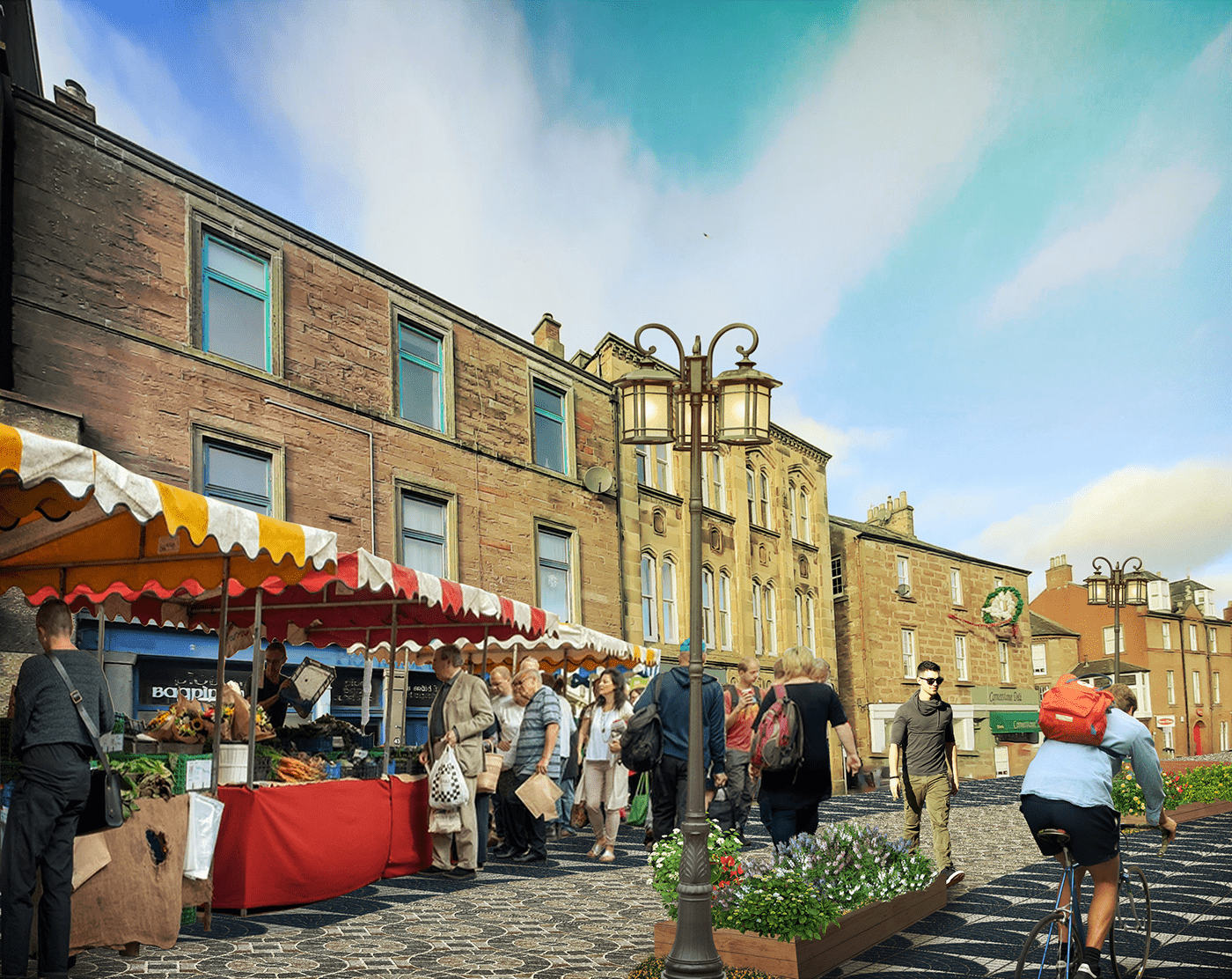
Proposed view of Wellmeadow street


A before and after comparison of the Allan street junction.


A before and after comparison of Croft lane.


A before and after comparison of one of the nodes on High street.


A before and after comparison of the High street.


A before and after comparison of Brown street.


A before and after comparison of the High street junction.


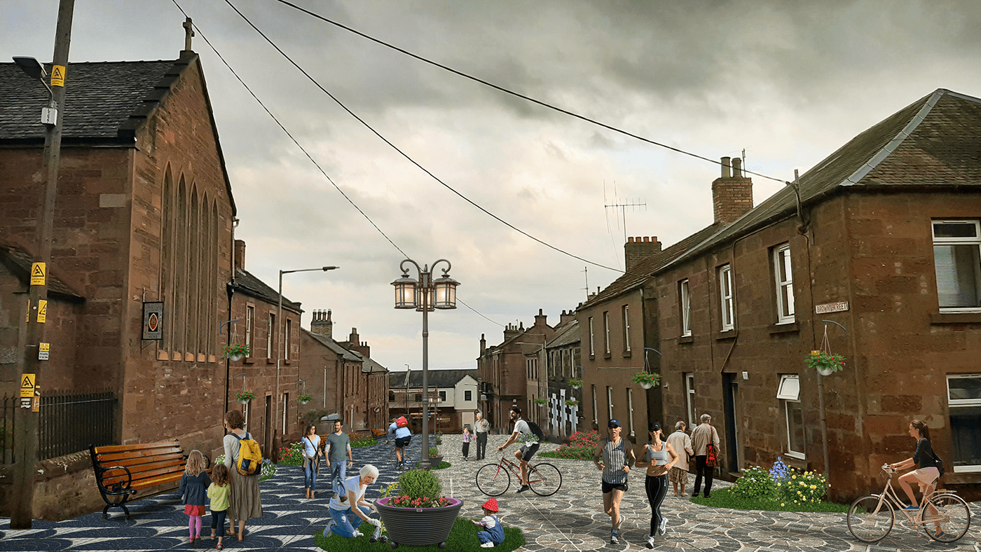
A before and after comparison of the Upper Allan street. The space here has the potential to be transform into a place that can host multiple functions at the same time, as well as act as a calm and tranquil public realm.


